Friday, July 28, 2017

Axial 2017 Wrap-up

Teacher Science Resource pages now available!
Axial Seamount Educational Resources
By Bill Chadwick
Chief Scientist

Our research expedition to Axial Seamount was a great success, thanks to the combined efforts of the crew of the R/V Revelle, the Jason and Sentry teams, and the science party. We were able to complete 5 Jason ROV dives, 5 Sentry AUV dives, 3 CTD casts, and we deployed 4 instrument moorings and we recovered 5 of them that had been out collecting data for the last 2 years. It was a big relief to feel we accomplished all our goals as we returned to Newport, OR, but the work of analyzing data and samples will continue for many months from now.

Scientists on the expedition. R/V Revelle returning to Newport, OR.

Two of the Jason ROV dives were mainly devoted to making pressure measurements at an array of seafloor benchmarks to measure how much the volcano has re-inflated since our last survey two years ago. We found the center of the caldera has risen 80 centimeters (nearly 3 feet) in the last two years, and 1.25 meters (over 4 feet) since the end of the 2015 eruption. That means the volcano has recovered half of the deflation that occurred during the last eruption in just two and a quarter years, but during that time the rate of re-inflation has also slowed substantially, from initial rates of 80 cm/yr to current rates of about 20 cm/yr. That means the second half of re-inflation will take longer than the first and the next eruption is probably not due before 2020 or 2021, depending on how the inflation rate varies between now and then. We’ll be keeping an eye on it through the real-time data from the OOI Cabled Observatoryand will be attempting to forecast the next eruption as it gets closer.
Blue mat at Marker N3 Vent site.
"Mini-smoker" on Axial's north rift zone.
Piece of hollow pillow crust with lava drips that had been extending down.

Map of AUV Sentry navigation.
Two of the other Jason ROV dives were devoted to sampling vent fluids and sulfide chimneys for chemical and microbiological analysis. One of those dives was in the caldera at vent sites that had been visited many times before, and we discovered that the “blue mat” has returned to the Marker N3 Vent site, which was paved over with new lava during the 2011 eruption. It’s remarkable that there is something unique about the chemistry of the vent fluid at that site that the blue mat (a protozoan ciliate) really likes. The other chemistry dive was to a new vent site discovered just a year ago by an MBARI-led expedition making dives on Axial’s the north rift zone. There they found “mini-smokers” that are very unusual in that they are high-temperature (we measured up to 321°C), but are located on top of the thick 2015 lava flows. We found these vents have a very different chemistry than the other hydrothermal vent sites in the caldera. The final Jason ROV dive was made along a graben (a narrow down-faulted block) along the NE rim of the caldera that traces the path of the dike that connects the 2015 lava flow on the NE caldera floor to another one on the rim. These parts of the 2015 eruption had not been visited previously, so we collected 14 new lava samples to fill in that gap. It’s always fun to get to explore new areas, and it’s fun that Axial Seamount still can surprise us even after all these years!

Sunday, July 23, 2017

STEM Careers

By Teresa Atwill

One thing many of the people working in STEM careers (Science, Technology, Engineering and Mathematics) on the R/V Revelle have in common is that they did not start out planning to work at the jobs they have today. For many, at some point they caught the ocean research bug. Somehow, the ocean just got into their blood and they had to keep coming back. Working on a sea-going research vessel for sometimes weeks or months at a time is not for everyone, but for those who choose this career they would have it no other way.

Andra Bobbitt
Present job: Data Management for the NOAA Earth Ocean Interactions Program, Hatfield Marine Science Center, Oregon State University

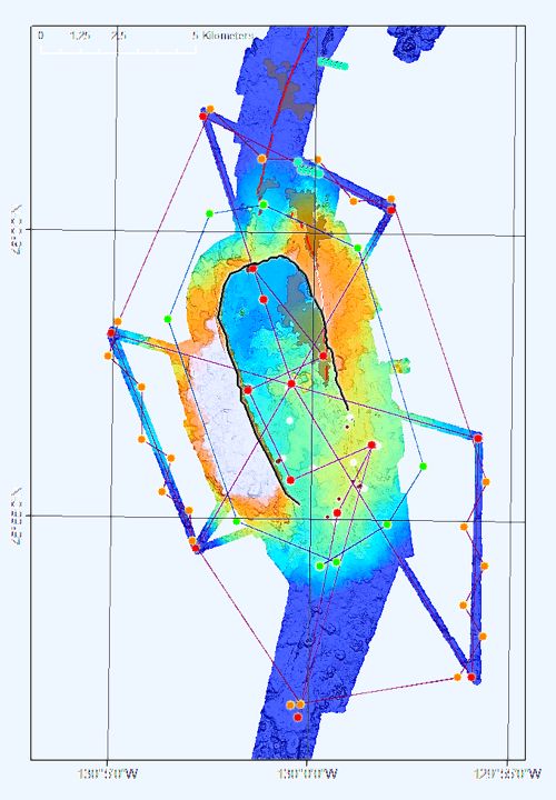
Andra earned her undergraduate degree in biology at University of California (UC) at San Diego. While there, she applied for a position to work at the Scripps Institution of Oceanography. At that time, ship navigation and seafloor studies were just beginning to develop toward the level they are today. At Scripps, Andra went on research expeditions and specialized in collecting and organizing the data, multibeam and making sense of the pre-GPS navigation. Andra honed her technical and computer skills on the job. While on Easter Island at the end of a research expedition, Andra accepted her present position at Oregon State University and NOAA. Her career has let her travel to various ports around the Pacific Ocean and to see amazing things on the seafloor. Her work is an integral part of this research expedition because it is so important to ensure that every sample, photo, instrument deployment and recovery be recorded both for time and location. Andra has been at sea at Axial Volcano many times and is a font of information about the various sites around the volcano that have been a part of this long-term study. At the end of this expedition, Andra will compile the Cruise Report and send it to the scientists, ROV and AUV engineers, and to the ship, and it will be available on line.

Scott Nooner
Present job: Teaching and doing research at University of North Carolina at Wilmington.

Scott is one of the principal investigators (PI’s) for this expedition. As an undergraduate, Scott completed a double major in physics and art at Hendrix College. He then went to Texas A&M to complete graduate work in physics, but while there he found that the pure physics research he was doing did not interest him as much as he had thought. He decided to take some geophysics courses and decided to switch his focus. After he finished his MS in Physics he moved to UC San Diego at Scripps to work on a PhD in geophysics. Scott started working at Axial Volcano with Bill Chadwick as part of his PhD thesis. Together they worked on collecting and analyzing the pressure data from Axial. Scott also worked on a project in the North Sea on injection of excess CO2 from gas wells into a saline aquifer. For that project he was also moving an instrument from benchmark to benchmark, but measuring gravity and pressure. Since that time he has added projects in Bangladesh and the East African Rift Zone. Presently, Scott does research, oversees graduate students and teaches classes at UNC Wilmington.

Brent DeVries
Present job: Scripps Institution of Oceanography computer tech

Brent went to UC Irvine and majored in political science and minored in computer science. His first job out of college was as a computer technician for the human resources department at UC Santa Barbara. Brent started looking for a job that would offer more adventure, travel and one where he would feel like he was making a difference in the world. So when he saw an advertised job at Scripps he applied. He was hired and now works as computer technician for Scripps at UC San Diego. He goes to sea about three to four months a year. When he is on shore, he works on the development of new computer systems for ships, monitors the ship systems remotely and generally solves computer tech problems. While at sea he works with sonars and computer network, the tech infrastructure, and works with scientists to make sure the ship is offering what they need. The biggest challenge for him is being away from family and friends, but now with advanced internet communication he can keep in touch even while he is at sea. The biggest technical challenge is when the ship’s network goes down. He really likes the marine biology expeditions to study the off shore California coastal currents. He has been to Africa and gone past Patagonia during his various trips at sea, so travel is one of the best things about this job as well as feeling like he is contributing to the science that gets done on each expedition.

Srishti Kashyap
Studying: PhD in Geomicrobiology at University of Massachusetts at Amherst.

Srishti is onboard to collect microbiology, rock, and mineral samples for collaborators and to use in her own experiments designed to better understand the chemical and biological behaviors of microbes that do not breathe oxygen to live (these are readily found at volcanically active spots on the seafloor). Srishti started with a double major in astronomy and biology as an undergrad at Mt. Holyoke College. After college, she worked for a year at NASA Goddard Space Flight Center. While there she worked with the Curiosity rover group (Curiosity is a robot sampler on Mars). She was part of the Sample Analysis at Mars (SAM) team, which focused on evaluating if Mars currently has or ever had organic molecules. While Curiosity was making measurements, Srishti was running wet chemical analyses analogous to those done on the rover to decipher the data received from Mars. Srishti’s search for life on other planets has led her to her current PhD research at University of Massachusetts. She is studying geomicrobiology. Her work seeks to understand how deep sea microbes transform minerals by breathing different types of iron oxides minerals. She wants to understand how microbes help form and transform these minerals at hydrothermal vents (the kinetics of these reactions, the mineralogy of these transformations and physiology of these organisms).

Chris Judge
Presently: Works for Woods Hole Oceanographic Institution (WHOI) on the Jason ROV team

From an early age Chris has enjoyed video games and electronics. He went to a vocational high school and studied electronics. He got a job after high school working for Falmouth Electronics. He started soldering circuit boards and moved up to testing the boards. In the economic downturn he was laid off and found a job at WHOI. He started there making magnetotelluric instruments and got interested in ROV’s. He started with the Nereid Under Ice (NUI) ROV and is now working with the Jason ROV team.


Lauren Roche
Presently: Sea-going Mooring Technician at Hatfield Marine Science Center, Oregon State University and the NOAA Acoustics Program

Lauren graduated from UC Santa Barbara (UCSB) with a BS in Environmental Studies with an aquatic biology focus. When she graduated she started to look for marine science positions. She was especially interested in scientific diving and an internship at UCSB on gray whale research led to her getting hired at UCSD Scripps to work on whale and dolphin acoustics. She worked on data analysis and she got to go to sea a lot. While on ships she would measure real-time acoustics and make observations of whales. That got her hooked on going to sea. After 4 or 5 years she was laid off when research funding got tighter. For a while she had a temporary job for the Oregon Department of Fish and Wildlife doing animal surveys. She began to look for other jobs in Oregon and saw that HMSC had a position. Her sea-going experience helped her land the job with the NOAA acoustics group. In the ten months she has been working at the HMSC she has been to sea three different times (once to Antarctica) for a total of two months on ships. Her job is to deploy and recover instruments as well as arrange the logistics and prepare instruments. She does shipping, purchasing parts and building instruments (like OBH’s -ocean bottom hydrophones) in the lab at HMSC. She is challenged by some of the electrical work involved and overall she loves the work she does.

Danik Forsman
Presently: Submersible Alvin pilot/mechanic for Woods Hole Oceanographic Institution.

Danik started his marine career working as a Commercial Diver. He graduated from Divers Institute of Technology, a dive academy located in Seattle, Washington. In general, commercial dive academies have a high drop-out rate due to the mental and physical stresses experienced during in water training. After completion of his training he went to work for CalDive, a California based commercial dive outfit that worked primary in the Gulf of Mexico. Danik was involved in deep-water salvage and pipe line restoration, acting mainly as a dive medic and underwater welder. After the Gulf of Mexico spill he decided to leave for moral reasons and look for work in science. A colleague of his had a contact at Woods Hole Oceanographic Institution who was hiring for divers and field techs. He applied and once hired worked as a scientific dive master for 5 years, doing scientific research around the world and training new divers and students. During that time Danik took courses in Ocean Engineering and learned CAD as well as machining techniques. He heard the Alvin program was looking for pilot candidates and after applying began training as a pilot/mechanic. Danik currently works for the Alvin group, taking scientists to the seafloor at depths of 3000 meters and helping them perform deep ocean research. When Alvin is not at sea Danik will work with other vehicle groups as a mechanic/pilot such as AUV Sentry or the Exosuit program.

Camilla Wilkinson
Presently: CIMRS Research Assistant, Hatfield Marine Science Center, Oregon State University and the NOAA Earth Ocean Interactions Program

Camilla grew up in England and attended the University of Greenish in London where she earned her BS in science and her Masters degree. Her Masters research was on chromite texture in the Trooclos Ophiolite. She then started work on her PhD at Open University. She worked on Argon-Argon Geochronology. She then got a post-doctoral position in Norway helping to run the Argon lab for their geologic survey. Argon isotopes are routinely used to date rocks in the range of 20,000 to over 1 billion years old. She was a member of the Nobel Gas Network and from that she heard about the job in Newport, Oregon at the Hatfield Marine Science Center working for the NOAA Earth Ocean Interactions program on Helium isotope studies.

Interested in a job similar to these? Or other jobs on ocean research vessels? Here are the web address for some of the major oceanographic institutions. Most are hiring right now!

Woods Hole
http://www.whoi.edu/website/HR/current-opportunties
Scripps
https://scripps.ucsd.edu/people/jobs

Saturday, July 22, 2017

The Last Dive

By Teresa Atwill

At about 3:30 am this morning, the Jason team began preparing Jason for its last dive of our expedition. At almost 4 am, the ships crew and the Jason winch operator and the rest of the Jason team lifted the ROV from the deck and lowered it into the water. After all systems are shown to be working then they added the 34 football floats and the transponder onto the cable. For this geology dive all of the chemical sampling equipment has been removed from Jason and extra milk crates with dividers have been added to Jason’s basket to hold the planned rock samples.

New 2015 lava draping over older lavas on the NE rim of Axial.
At about 5:20 am the bottom was reached and we found one of the lava flows that erupted in 2015. I have spent a lot of time in Hawaii on Kilauea Volcano and the features seen here look very familiar to me. We see glassy lava with ropy features and thin flat crusts that have rafted into each other. In some areas the lava is jumbled and broken up. We collect samples with Jason’s manipulator arms and this is hard to do as the glassy surface of the new lava breaks so easily and the gripper jaws on Jason’s arm are made to be strong, not delicate. The Jason pilot on this watch, Jimmy, manages to get a piece of lava into one of the sample boxes, but some of the samples are easier to collect than others. It is hard to design a manipulator arm that can be strong, withstand the pressure in the deep ocean, and yet can also delicately pick up fragile rocks.

We see some cool pillow lavas from the 2015 eruption flowing down over the jumble of rocks and boulders at the base of the caldera wall. We collect another rock sample and Jason begins to rise up the side of the caldera about 65 meters high. Some of the caldera wall is a sheer rock face and we can see features like lava tubes and pillows that have been cut in half as if by a giant knife. This reminds me so much of road cuts along the Hawaii National Park Chain of Craters Road, but here we are a mile underwater.

Collecting 2015 lava sample.
At the top of the caldera rim we begin to move along a large graben (a down-dropped block between two faults) with deep fractures running northward. There is no fresh lava here. These features are similar to those seen on rift zones in Hawaii. On both volcanoes the open fractures generally parallel the rift zones (areas where the lava moves outward from the under the central caldera), where over and over again new lava is injected in dikes and sometimes erupts out of fissures.

After several hours of zig zagging across the graben while driving Jason northward and looking at the fractures the Jason team shift changes. Everyone takes turns eating breakfast and returning to the control van. At about 8:15 am we see some 2015 lava in the crack of a fissure. This is where a dike, or magma filled crack, reached the surface and lava squirted out. Much of the magma stayed underground in this part of the rift zone. We see fissures, but not much fresh lava.

Control van view of lava pillar to be collected (center of large screen).
At about 8:30 am we reach an area that has 2015 pillow lavas and we take a sample. We continue up the graben toward where we know there are larger 2015 lava flows, but we are filling in a gap that has not been explored before. We are the first to see these features and to sample these lavas.

At times during the dive, as we sit in the control van, it feels like one of those virtual experience rides, where you sit in a simulator and they show you flying in a space craft. The R/V Revelle provides some dips and rolls that match with Jason’s video movements and you feel like you are in a submersible flying (although slowly) through the water. As we move into the area where more lava erupted on Axial’s North Rift Zone, we see larger areas that are covered by thin ropy lava. There are really interesting sites that have the new lava flowing under, around and on top of the sediments that were here before the eruption. We saw sea pickles all over the lava flow. They are not supposed to be here and never were before. Now they are everywhere. They belong in more tropical waters, so it is worrisome to see them here, and are another piece of evidence of changing ocean conditions.
Pillar collected in photo above right.

We saw a number of cool lava pillars and areas of lava-sediment interactions. We ultimately collected 14 rock samples from the 2015 lava flows, and it's time to head back to the surface. We all must be getting hungry, as a discussion of where to get the best pizza in port ensued.

Back on deck at noon.

Friday, July 21, 2017

Our Own City

By Teresa Atwill
The most important people on the ship, the cooks!
There is a small village out here on the Revelle. It is a floating city with work going on around the clock. The Revelle was designed with ocean science in mind, and the ship could stay at sea for a couple of months if need be. The Revelle makes its own water and has a sewage treatment plant. There is a laundry room, dining hall, library (with lots of books!) and even a movie room. It is amazing to go on deck and to see nothing but ocean for as far as you can see, because inside the ship it feels like you are part of a self-contained community with an amazing number of moving parts. I have been on board for a week and still have not been to all the parts of the ship or met all of the crew.


Here is a movie of what it is like to get one from one place to another, in this case the Bridge to the laundry room:

The ship is 274 feet long, and has more than 5 levels. The sleeping quarters are on 3 levels, another level is the mess hall, kitchen, library and movie room, all the science labs are on the same level as the main deck. The engine room takes up two of the lower levels. If you want to take a virtual tour of the ship you can visit this Revelle website:
https://ushydro.ucsd.edu/virtual_cruise/tour_revelle/index.html 

When I first got on Revelle it was really easy to get lost. It felt like a labyrinth. Lots of things look the same – tan metal walls and doors everywhere. I set a reference of the mess hall level in my head, as it is in a central location as I ran up and down the stairs. So everything was either up one or two floors from the mess level or down one or two floors. The science labs are down one level from the mess. The Jason control van is on the same level as the mess and my room is one level above the mess.

View a time-lapse movie of dinner being served in the mess:


A typical snack selection aboard the Revelle.
There are three main meal services at set times everyday and all the food is pretty good. It is amazing how we can have fresh fruit and vegetables after leaving the dock over a week ago. Each day the food served varies quite a lot. For lunch and dinner there is always salad makings. Dinners also include a dessert. Just two people make all the food for fifty-five people for three different meals each day. If that is not enough food for you, or you miss a meal because of your work schedule, there is also lots of snack food available and a refrigerator with leftovers.

"Essential" expedition equipment.
A couple of us scientists from Oregon are really picky about our coffee and so we brought our own espresso maker and we have it set up in a small lab that is not getting used that much.

The ship is run by 22 crew members, and ten of these work in the engine room, including an electrician, engineers, ‘oilers’ and ‘wipers’, each with different duties. We took a tour of the engine room and it was amazingly clean for a ship that is 20 years old, but so noisy we had to wear ear protection and use hand signals to communicate! In the engine room they also house the fresh water desalination plant and the sewage treatment system. They even have a machine shop that can build or repair almost anything!

I wrote earlier about the marine technicians and our computer tech. The rest of the crew include the deck crew and the officers that work on the bridge and drive the ship. The bridge crew are professional, friendly, and helpful. The ship’s crew are an integral part of accomplishing our science goals out here.
Various photos from below decks in the Engine Room.
It is really an amazing experience to be at sea on a research vessel, but just remember: While at sea no one gets a day off! So by the end of the cruise all of us will be exhausted (but happy) and ready for a little time off.

Thursday, July 20, 2017

Can We Take the Pressure?

By Teresa Atwill

Some things are so much easier on land. At volcanoes above sealevel you can pick up a Global Positioning System (GPS) receiver and some tiltmeters and hike up the mountain to measure the ways a volcano deforms as molten rock moves into a magma chamber or up to the surface. Our chief scientist, Bill Chadwick, started his career as a volcanologist at Mt. St. Helens measuring volcano deformation.

View this animation of Axial's inflation and deflation during an eruption:


Learn more about volcano inflation and deflation at Mount St. Helens Learning Center site:
http://www.mshslc.org/activity/volcano-deformation/

But on submarine volcanoes, these same kinds of measurements are much more challenging. For the last 3 days we have been utilizing the ROV Jason to collect pressure measurements at benchmarks on the seafloor within the summit caldera at Axial Volcano and at the reference point to the south. The goal of the pressure measurements and Sentry multibeam re-surveys is to measure how much the seafloor is moving up or down, and thereby increase our understanding of how magma moves in and out the plumbing system beneath the surface of Axial volcano. We know that Axial has erupted 3 times in 1998, 2011 and 2015, and after each eruption the surface above the magma chamber of the volcano deflated like a balloon as the magma erupted onto the seafloor. The deflation during the 1998 eruption amounted to 3.5 meters (11.5 feet!) and was documented with two Bottom Pressure Recorder (BPR) instruments.

Pressure measurements documenting inflation and deflation with each eruption at Axial.

Since that time, Bill Chadwick and Scott Nooner have been adding measurement sites, different types of pressure measuring instruments and finding new ways to measure the volcanic deformation in collaboration with colleagues at the Monterey Bay Aquarium Research Institute (MBARI). The more data we have about the deformation of the volcano, both in space and time, helps them model what is going on beneath the seafloor and how and where magma is stored, and how the supply to the volcano changes with time.

Watch this fly-through of Axial Seamount from the south to the north. Benchmarks are black symbols and the vents are white. 10x's vertical exaggeration of bathymetry.  (animation by Susan Merle):


Why and how to measure pressure?
On the seafloor we can’t take out a GPS recorder and get our elevation from the Global Positioning System (it doesn’t work underwater). One way to precisely measure the elevation of the seafloor is to measure the pressure at the bottom due to the height of water between the seafloor and the ocean surface. If the seafloor moves upward, the height of the water above it is decreased and so the pressure measured at the bottom goes down. The opposite is true if the seafloor moves downward. The pressure sensors can detect vertical movements as small as a centimeter or better (2.5 inches)!


Cartoons demonstrating how pressure, water depth and seafloor depths change after eruptions.

Scott Nooner removing mini BPR's recovered by Jason.
On our cruise we are measuring the pressure at 10 different benchmarks on the seafloor. Six of the benchmarks have had Mini Bottom Pressure Recorders (Mini-BPR’s) on them that have been recording pressure for the last two years. We are collecting these and replacing them with new instruments. Once brought back on the ship the Mini-BPR’s will have their data downloaded and analyzed.

Three benchmarks (that do not have mini BPR’s) are near bottom pressure recorders and tiltmeters that are part of the Ocean Observatory Initiative’s Cabled Array. These instruments are wired to an undersea cable and collect pressure data continuously.

You can see this real time pressure data live at NOAA EOI's site:
https://www.pmel.noaa.gov/eoi/rsn/index.html

You can download and plot the data yourself at the OOI site:
http://oceanobservatories.org/instrument-series/botpta/

OOI depictions of the cable array from Oregon to Axial Seamount.

Axial volcano has been re-inflating (re-filling with magma) since the last eruption in 2015. The level of the ground rising at each benchmark is different and taken as a whole these varied levels give us a picture of the depth and shape of the magma chamber and the movement of magma in the volcanic system. The challenge is that we need to have all the measurements in some way tied to a standard, so we can compare them. Each continuously recording BPR has a level of drift of the measurements separate from the other BPR’s. To correct for this drift, we do this long three to four day survey, where we have the Jason ROV take a single Mobile Pressure Recorder (MPR) around to each of our benchmarks to tie all the separate measuring devices together. This process results in much more accurate measures of the uplift of the volcano surface over time as it re-inflates before the next eruption. Ultimately, these measurements also enable us to forecast the timing of the next eruption, see NOAA EOI's site: https://www.pmel.noaa.gov/eoi/axial_blog.html

Watch this video of the mobile pressure sensor (MPR) being deployed on benchmark:


It’s still a bit early to tell, but it looks like the next eruption at Axial Volcano is still at least several years away.

Wednesday, July 19, 2017

The Dance

By Teresa Atwill

Sunrise on the R/V Revelle at Axial Seamount.
To run a complex interdisciplinary research expedition like the Axial 2017 research cruise on the R/V Revelle requires coordination and communication between the ship’s crew, the ROV Jason and AUV Sentry teams, and the science team. Like a complicated dance company performance, each person has specific roles to be fulfilled and the timing of events is crucial. Mistakes could result in something as minor as lost data or samples or as major as damage to the ship or research instruments. Communication is key to keeping everyone’s efforts well-coordinated.

Navigation
One of the areas where there is the biggest need for communication and coordination is navigation of the ship and the ROV Jason as they move together during dives around Axial Volcano. When Jason is transiting between benchmark sites for pressure measurements on our cruise the Jason navigator uses software to let the ship’s dynamic positioning system know where it needs to move to next. They need to move at a speed that keeps the Jason ROV and its cable in the correct orientation to keep the vehicle and its cable safe.
Jason's view of the ship navigation.
The Revelle bridge officers monitor the bow and stern (both port and starboard) thruster output and the seas and winds and choose a heading for the ship to point into that minimizes how much the ship’s engines have to work. So right now as Jason and the ship move northward toward our next benchmark on the seafloor the ship’s bow is actually pointing to the southwest and the ship is crabbing backward to get there at a half a knot. The Jason cable is entering the sea from the winch on the port side of the Revelle and this also requires both the bridge and the Jason team to work to keep the Revelle moving in a way that keeps the cable free of the ship.

View this movie of the navigation (ship is blue, Jason is green and the acoustic buoy on the wire is pink):

Deployments and Recoveries
The Revelle’s marine technicians (referred to as ResTechs) Josh and Jim serve as the liaison between the scientists and the ship and oversee and run any deployment or recovery of instruments or vehicles over the side. They are responsible for the safety of everyone working on the deck and ensuring that no equipment is damaged during deployments or recoveries. For safety everyone involved has to wear hard hats and work-vest life jackets. For the ROV and AUV deployments the ResTechs and the rest of the ship’s crew must work in tandem with the Jason and Sentry teams that operate the vehicles.
ResTechs Jim (left) and Josh (right).
The ResTechs have radios to communicate with the bridge about what is happening with the deployments or recoveries and the bridge can also watch what is happening with shipboard cameras. The ResTechs also use hand signals to communicate with the Revelle winch or A-frame operator.

For example, to recover the Sentry AUV the following steps occurred. First the dives of both Jason and Sentry had to be pre-planned and designed by Chief Scientist Bill Chadwick to bring Sentry back from its long (24 hr) multibeam survey to meet the ship at a specific time and place as it moved with Jason to different sites within Axial Caldera. (This is sort of like the plan to have the Lunar Lander meet up with the orbiting Apollo space craft). In this case we have three moving objects (Sentry, Jason and the Revelle) in a 3D ocean world moving at different rates and hopefully not running into each other! The Sentry team kept checking on Sentry’s path and provided updates to Bill, the ship’s bridge, and the Jason team as the rendezvous neared.

AUV Sentry driving toward the ship.
When Sentry was about an hour out, Jason was lifted off the seafloor so that the ship would be better able to maneuver for the Sentry recovery. About half an hour out, Sentry dropped extra dive weights it was carrying so that it could leave the bottom and rise more quickly to the surface. Twenty minutes later Sentry was seen at the surface and the Sentry team drove Sentry closer to the ship with a radio frequency control console. As Sentry came up along the side of the ship, the Revelle dynamic positioning system was set to hold position and as the thrusters tried to do this they pushed Sentry back a few meters. Sentry was then driven closer to the ship again and the Sentry team had hooks on poles to latch onto and at the same time hold off Sentry from the side of the ship. The lifting hook was attached to the ship’s crane and Sentry was then lifted out of the water and onto the deck of the ship. Once Sentry was in its cradle on deck, Jason could then go back down to the bottom to continue its job of visiting pressure benchmarks with the Jason crew returning to coordinating the ship’s movements and driving Jason.

Science Data
There are crew from the Revelle, Jason and Sentry team members and the scientists involved in the collection and organization of all the science data during the cruise. The goal of this process is for all the navigation and science data to be cataloged and organized and made available to not just the scientists involved in the cruise but also for the general public to access. In the Jason Control Van there is always a combination of Jason team members and scientists discussing where to take samples or conduct experiments with people from the science party recording events. Photos, videos, navigation and other details are recorded continuously. This information will become part of a cruise report and will be available on-line after the cruise in what is called the Jason “Virtual Van” at this web site, click on our cruise "RR1712":
Virtual Van Website (http://www.whoi.edu/page.do?pid=12876)

R/V Revelle's computer tech, Brent.
The scientists and engineers have fairly heavy computer, network and printer needs and there is a Revelle computer tech, Brent, who is in charge of helping us with this. He has already fixed computers that were misbehaving and has helped set us all up with access to the ship’s network. The only way we can access the internet is through a satellite link and it is expensive, so there are limits to what we can do online.

Dance Missteps are Dangerous
There is risk in not managing the dance correctly - if Sentry gets to the end of its dive and the battery power gets lower than 5%, then it automatically aborts its dive wherever it is and comes to the surface. If the ship is not there to recover Sentry, it would start to drift away quickly in the surface currents. If that occurred away from where we were with Jason, we would have to abort the Jason dive, recover Jason and rush off with the ship to recover Sentry. So that's another reason "the dance" is so important and critical to get right. It could waste a lot of time and up-end our cruise plan for it to go wrong. Plus we don't want to lose Sentry!

Tuesday, July 18, 2017

It’s Magical

By Teresa Atwill

Jason testing thrusters while deploying.
During this cruise we are choreographing a complicated dance with the two underwater vehicles, Sentry and Jason. We have Sentry off making multibeam surveys as described in the “Text Messages and Transducers” blog post and Jason is running a multi-day pressure survey dive (more about that later). Sentry went into the water at about 8 pm last night and Jason began its dive at 4 am. We are all tired this fifth day of the cruise, especially the chemists who were up all night dealing with samples collected during yesterday’s Jason dive to the International District vent field to sample high and low temperature vents. The video footage of the sea floor venting sites was amazing and we will add some Jason video from the dive in a few days.

The video below show the control van displays while sampling the  top of "El Guapo" vent  with the fluid sampler.  Scientists are controlling the camera on the center panel and viewing the biology down the chimney while the pilot is sampling the flaming fluid:


But for now I want to describe a few amazing things about Jason. There is something magical about the ROV Jason and its control van. Jason is tethered to the ship by a fiber-optic cable, which provides power data communication to Jason. As the ship moves on the ocean surface, Jason moves along with it just above the seafloor nearly a mile below. In the control van, the Jason team monitors and controls Jason and we can all see live video of the seafloor. In the last year or two there have been some major changes to the Jason vehicle, deployment systems, and the control van.
Overview of the Jason control van.  Pilot is sitting in the center of the photo.


In fact, the Jason control van is new on this trip and is getting its first ‘at sea’ experience and has been working very well. There were a few issues to be resolved in the first few days of the cruise and the Jason team worked long hours to get everything ready for our first dive. This new control van is more spacious and comfortable than the old one. More people can be in the van during dives and the screens are much bigger for looking at the high-resolution video and all of the other data coming from Jason during dives.

It is amazing to see all the screens in the control van, and I am going to describe some of them and what they do. There are at least 10 cameras on Jason. There are 3 main forward facing cameras that can be directed to look in different directions. There is one camera looking up at the cable and one facing downward at the seafloor. There is also a camera looking backward, like a rear-view mirror, and one looking at each manipulator arm. Another camera focuses on the dials of hydraulic pressure on the vehicle. Most of the images from these cameras are displayed in the control van. In addition, there are screens showing navigation information about the ship, Sentry AUV and Jason. All of these views can be moved to different screen locations or can be shown in different sizes depending on what is needed for the operation at hand.

In the photo left, the screen shows the locations of the ship, Jason, the transponder about 140 meters up the cable from Jason, and if Sentry is nearby it will show Sentry’s location too. The Jason team manages the position of Jason relative to the ship in such a way that no kinks or twists occur in the cable and to make sure this does not happen the pilot and navigator are always monitoring the way the cable is oriented between Jason and the ship. 
Attaching the Jason floats on the wire.

There are 34 syntactic foam footballs above Jason on the cable to help keep the cable off the seafloor and in the correct ‘S’ shape to allow Jason to be buffered from the motion of the ship at the surface. Each football float costs $600, because they are made of syntactic foam (a high-tech material that stays buoyant at high pressure), so just the footballs alone cost about twenty thousand dollars. That is how important the cable is to the Jason group. The football floats have to be attached to the cable during each Jason deployment and removed during each recovery.

There are two or three screens in the control van showing various aspects of the winch and cable to the Jason team. When Jason is actively being piloted there is a navigator, pilot and engineer all keeping track of various parts of the operation. The navigator usually has control of the ship and coordinates Jason’s movements with the bridge and the Jason pilot. The pilot “drives” Jason by controlling Jason’s thusters and also controls the manipulator arms when Jason is deploying instruments or collecting samples using various joystick controls.

Different views of Jason's wire and winch.

Jason's Pilot control console.

I find every aspect of the Jason operation fascinating. Crowds gather on the back of the ship (photo below) to watch Jason be deployed or recovered. The control van usually has a few visitors watching the action.


The most amazing part is watching the magical aspects of Jason’s activities from the control van. I could stay in there all day. The high-definition video feeds from the sea floor are beyond belief. I have to remind myself that this is all going on directly under my feet a mile below the ship. It’s not some TV show from somewhere else – this is happening right here and right now. How cool is that? It’s opening up a key part of our planet to viewing and exploration that few humans have ever seen. I know that the scientists, busy as they are completing their research, will also occasionally stop now and then and just stare at the wild and wonderful environment we are visiting during this research cruise.

Watch this video of the control room while sampling the anhydrite (high temperature vent) "Diva"...it's magic!:


Monday, July 17, 2017

Text Messages and Transducers

By Teresa Atwill

Sentry Team preparing for the dive.
The autonomous underwater vehicle (AUV) Sentry is going to start its second mission of our research cruise today. Right now Sentry is getting it’s batteries topped off and the AUV’s programmer and lead engineer are converting the chief scientist’s “way points” (latitude and longitude locations) into a set of instructions telling Sentry to do things like head east 1.2 kilometers and then drop to 65 meters above the sea floor and turn on its multibeam sonar.

Sentry starts a dive with a pre-programmed series of distance (range) and direction (bearing) instructions that it will follow and will take it far from the ship (about 10 km or 6 miles) during which Sentry will record very precise (within 10 cm elevation) multibeam sonar bathymetric data with a horizontal resolution of ~1 meter. Every 6 hours or so Sentry must come back within acoustic range of the ship to text message with the Sentry team through a transducer (acoustic modem) on the bottom of the ship and communicate things like how much battery power remains and how Sentry’s other systems are working. The Sentry team can also send Sentry a text message to tell it to offset its track slightly to compensate for any navigational drift that has occurred during its travels alone in the ocean.

Image of an actual live Sentry track screen. Red lines have been confirmed to have run. Green lines are the rest of the set track.


The final result of the Sentry missions on our research cruise will be high-resolution bathymetric maps that will be used to measure any changes in elevation of the sea floor by comparing this summer’s measurements with those from previous years. These changes in the sea floor are primarily due to subsurface magma movement inside Axial volcano.


Chief Scientist Bill Chadwick discussing Sentry navigation:


Most people who use Sentry to survey in a “mow the lawn” pattern to create bathymetric maps of previously unmapped areas. In contrast, on this cruise we want to measure deformation of the volcano by repeating previously mapped survey lines to look for changes in seafloor elevation. We also want to do these repeat surveys over a large area to reveal the spatial extent of the deformation. Most people map assuming the sea floor topography will never change (which is true in most areas), but here at an active volcano, the seafloor moves up and down as magma moves in and out of Axial Seamount. Comparison of these surveys from year to year allows us to measure deformation at the volcano as it inflates and deflates over time. This process of comparing high resolution AUV multibeam data in order to determine volcanic deformation on the sea floor was developed by the scientists on our cruise in collaboration with scientists at MBARI (Monterey Bay Aquarium Research Institute).


Before developing this method with the AUV data, pressure measurements (for inflation and deflation) were only at specific points but Sentry gives us information over a much greater area. On the other hand, these AUV measurement comparisons are not as precise as our pressure measurements (more about those in a later post), so it is good to have both kinds of data when developing our models for the volcanic activity at Axial.

Sentry Navigation
Map of Axial showing the waypoints for measuring deformation.
For Sentry navigation to be at its best we would need to keep the ship close to Sentry at all times. That way we could use the GPS coordinates of the ship to keep communicating with Sentry about its location on the seafloor. As Sentry moves through the water it uses a down-looking Doppler sonar to tell it how fast it is moving by measuring the phase shift of sonar pings off the sea floor. The farther Sentry goes away from the ship the more this method of navigation drifts. We are trying to repeat surveys that were done in previous years, so we need fairly accurate navigation for Sentry. We are using Jason at the same time, so we can’t always follow Sentry around. When Sentry is out of acoustic range of the ship we can’t tell it where it is, therefore we design our surveys to return Sentry to where the ship is working every 6 hours or so during a 24-hour dive.

In the end we’ll be able to determine how much the seafloor has risen since the last AUV survey a year ago and what that can tell us about how magma is supplied and stored inside the volcano. We know that Axial is already building to its next eruption and this information will help us forecast when that is likely to occur.


Sunday, July 16, 2017

The Thin Line - First Jason Dive

By Teresa Atwill, Teacher at Sea

What happens in the rocks beneath the ocean floor at volcanoes and mid-ocean ridges? 

How do the gases, fluids and heat from the magma and hot rocks below interact with seawater and the microbes that live in the rock-water interface? 

Cartoon showing the water and chemistry circulation at mid-ocean ridges
Amazingly this is one of the largest habitats for microbial life on our planet! Some scientist estimate that there may be more microbial life beneath the seafloor than anywhere else on the planet – the so-called “sub-seafloor biosphere”. How do these interactions at mid-ocean ridges that occur throughout our oceans play a role in the greater chemistry and heat balance in our oceans and the planet?

To answer these questions the chemists and microbiologists on board collect hydrothermal vent fluids from the thin interface between the rocky crust and the open ocean and try to deduce from them what is happening beneath the seafloor. To understand how hard this is to do, think of the analogy of doctors trying to determine what is going on in your body with only an ability to look at your skin, analyze your breath and if they are lucky take a blood sample.

Dave Butterfield explaining the different types of venting at Axial.
Dave Butterfield is the lead scientist for our first Jason dive of our research cruise. For the last few days, Dave with the help of Kevin Roe, Tamara Baumberger, Srishti Kashyap, and Camilla Wilkinson has been prepping the sampling instruments that will ride down on Jason and will be used to collect vent fluid samples at different sites during the dive. There are two main types of sites to be sampled - focused jets of high-temperature water on mineral chimneys and warm diffuse venting issuing through animal communities. The instrument that goes on Jason for vent fluid sampling is the nicknamed “The Beast”, due to it’s large size and its enormous appetite for vent samples (16 water samples, 6 DNA filters, 2 gas-tights, and sensors). After this most recent retrofit of Jason “The Beast” barely fits into Jason’s underbelly.

Gas Chemistry
The Beast loaded on ROV Jason.
In addition, Camilla and Tamara have 5 gas-tight sample bottles going on Jason’s first dive. These will be used to sample the gases coming out at high temperature vents. The amazing thing about these sample bottles is that they can keep the samples they collect at the same high pressure as at the seafloor, even after they are brought back aboard the ship. This allows us to capture and analyze all the gases in the vent fluids before they come out of solution and escape when the pressure is reduced.

Millie and Tamara with the gas extractor.
Once back on the ship these sample bottles will have the gas extracted and this gas will be placed into glass ampoules. There are two types of gas ampoules used. The first is made of aluminum silicate and will be used for storing samples to be tested back on shore for helium and neon. The second type of ampoule (made of Pyrex glass) will be used for holding samples to be tested for total gas levels, methane, hydrogen, carbon dioxide, oxygen, nitrogen, ethane and butane.


Microbiology
Srishti hopes to collect 1-3 hydrothermal chimney rock samples (preferably more sulfide than anhydrite rich) for spectral analysis and microbial enrichments. Srishti is a graduate student and will be trying to grow novel heat-loving microbes that live at temperatures between 55-80°C and consume different types of iron oxide minerals. Who knew microbes eat rocks! Apart from enrichments, the chimney samples will also be used for spectral analysis to get a better understanding of the mineralogy associated with the cultured microbes. Most of these analyses will be done when back in the lab, but we will begin the enrichments on ship. Srishti also plans to filter the diffuse vent fluid samples for DNA analyses led by Julie Huber. These samples will be used to continue a long-term time series to evaluate the changes in the microbial communities at these vent sites related to volcanic activity. Microbes collected on filters will be analyzed once back in Woods Hole, MA.

Vent Fluid Chemistry
CTD being recovered from the ship.
The majority of the water sample bottles on Jason (and in our CTD casts) are set to hold samples for Dave Butterfield’s chemical analyses. Dave and Kevin will run some measurements on the ship and store some samples for additional measurements later. With other ongoing projects it can take up to six months for Dave and Kevin to finish all of the analyses on these samples. Hydrogen and methane analyses are run with a gas chromatograph at sea, as well as pH, hydrogen sulfide, and dissolved silica.

To learn about what is happening below the seafloor, back at his lab in Seattle, the samples collected at sea will be tested for methane, hydrogen, major elements (sodium, chloride and others), mineral-forming metals (iron, copper, zinc), trace elements (cesium, uranium, molybdenum and others), nutrients and dissolved organic carbon.

You could say that Dave Butterfield has been obsessed with Axial Seamount, which was the site of his first submersible dive to the seafloor as a grad student in 1986. 2017 marks the 19th year of a near-annual time series started in 1998 (the NeMO project).
Dave Butterfield (left) and Kevin Roe (right) working on fluid samples collected from Axial.

This is an unprecedented record and can be used to look at how the hydrothermal chemistry changes over time and is affected by the volcano’s periodic eruptions. By analyzing this thin layer at the interface between the ocean and this submarine volcano our understanding of what is happing in the rocks below the surface is greatly increased.